
Geodetic research and highway design
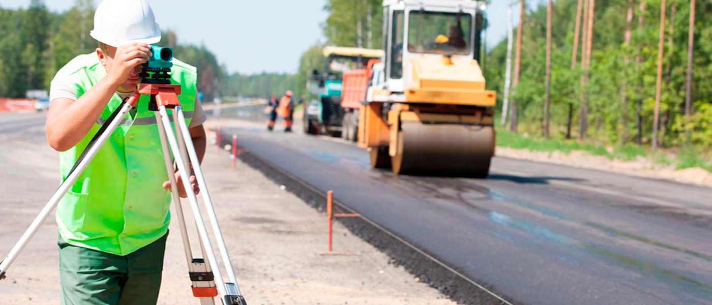
The construction of residential, industrial and infrastructure facilities requires a thorough study of the area. Engineering research and design of highways is an important stage preceding their construction. The reliability, convenience and durability of the highway depends on it. Competent performance of geodetic works guarantees the safety of operation of objects.
![]()
Features of geodesy
during the construction of roads
Designing and searching for highways and airfields has its own peculiarities. They are mainly related to the large length of the objects. And as a result, the presence of structures crossing the future highway — bridges, tunnels, aqueducts, etc.
First, a survey is conducted to measure angles, distances and directions to other objects. Next, a breakdown is made according to the finished project, and theoretical schemes of the future road are laid out in nature with markings near. Planned objects along the highway or railway are also being demolished.
At the same time, the principle "from general to private" and the following order is followed:
- Study of available materials, creation of detailed drawings, determination of work deadlines.
- Fastening on the territory of temporary rappers, further recovery with the help of bindings.
- Detailed breakdown of the site, road surface, communications, infrastructure, bridges, etc. Characteristic points of the road are shown, turning curves are indicated.
- Checking the accuracy of works is carried out by executive surveying and geodetic control.
When geodetic works are performed
during the construction of highways
First, it is necessary to decide on the optimal site for future construction. For this, geodetic measurements of the area are carried out, which also include lines that adjoin and intersect with other objects. After reconnaissance and tracing, the breakdown of axes is performed, as well as curves for secondary roads. The breakdown of the road is carried out when the approved project needs to be tied to the real terrain. Thus, the work is preceded by the development, approval and examination of design and estimate documentation.
Carrying out work requires high accuracy of execution and full compliance with design data. The construction quality and operational characteristics of the new road depend on this. Therefore, it is better to entrust geodetic grading work during road construction to professionals. Only experienced geodetic engineers who perform work in accordance with current state regulations are able to ensure the required accuracy.
Stages of construction works
Company "Gutman Construction"
All road construction works can be divided into several stages. Moreover, the quality of each of them is reflected in the final result.
Highway design
The design of a linear object includes a large amount of calculations, drawings and studies. Including geodetic works during the construction of roads, which are aimed at studying the relief and features of the landscape of the area.
At the same time, the presence of natural and artificial objects — buildings, structures, reservoirs, pipelines, etc. — is taken into account.
The works are carried out by topographic surveying of the entire section of the future route. They help to choose the optimal path of the road, rationally use materials and make other reasonable design decisions. In addition, they allow predicting the impact of climate and natural phenomena on the functioning of the future facility. And, if necessary, provide for measures that will help minimize this impact.
Preparatory stage
Preparation for construction begins directly on the site.
It consists in determining and transferring benchmark points to nature, as well as developing a geobase — an engineering topographical plan of the territory with initial geodetic information about the site with reference to geographic coordinates.
The geobase displays the following data:
- plot area;
- shape, dimensions and coordinates;
- availability of communications;
- other features of the territory.
Road construction
Research, design of the road are only the preliminary stages of construction. Next, the laying of the highway begins according to the developed project.
During the works, the geometry of the highway is controlled.
In addition, executive surveying is carried out in certain areas to control:
- dimensions and thickness of the asphalt covering of the roadway;
- slopes and the ability to drain rainwater;
- markings of the border and rain receivers;
- underground engineering communications under the road surface;
- ground structures - bridges, overpasses, pipelines and others;
- rounding radii with room for turning oversized vehicles.
Geodesy in road construction
breaking base
The research and design of railways and highways begins with a geodetic breakdown base — the removal and fixing of benchmarks. They are oriented there when transferring a linear object from the project to the nature. At the same time, geodetic and measuring tools are used. After the longitudinal axis of the future highway is installed, the temporary benchmarks are usually replaced by wooden ones with metal pins.
How we perform geodetic works
during the construction of railways and highways
Company "Gutman Construction" company offers geodetic surveys for linear objects of any level of complexity. After receiving the technical task and signing the contract, our qualified specialists start work. The most modern high-precision equipment is used to conduct them, which guarantees full reliability of the results. As well as all our accumulated many years of experience in the implementation of similar projects.
Calculation of the cost of works
The price of road surveying is determined individually and depends on various factors. The main ones are the type and size of the object, the number of turns, the complexity of the terrain, the density of buildings, etc. We value our customers and maintain an affordable level of prices for consistently high quality work.
Preparation of design drawings
Graphical materials are necessary to determine the methodology for carrying out detailed measurements and building detailed diagrams. They also indicate the breakdown elements - the lengths of the sections and the angles that will need to be measured along the highway. All documentation is compiled by our engineers at a high technical level. And in full compliance with all established norms and standards.
Geodetic breakdown works
during the construction of highways
After the development and approval of the design documents, they begin full-scale demolition work. At the same time, surveyors strictly focus on the developed network of breakdown and anchoring landmarks. During the works, the following is performed:
- division of straight sections of the track;
- breakdown of road segments in places of roundings and turns;
- detailed work taking into account all elements of the highway.
Types of geodetic measurements
during demolition works
Various types of measurements are used to create a partition network and bring it to life. Yes, horizontal distances between points are measured using rangefinders. Calculation of height coordinates usually requires leveling. Angles are measured with theodolites or total stations. To guarantee accuracy, all measurements are duplicated by performing in two directions - forward and reverse. That allows you to reduce the possibility of error to almost zero.
Geodesy in highways
search
The initial study of the future route is carried out in three stages:
- Collection and analysis of archival data of the locality, visual study of the territory.
- Carrying out the necessary surveys and measurements to assess the current state of the site.
- Identifying potential hazards, performing the necessary calculations and drawing up a report on the feasibility of the project in this area.
It is worth noting that geodetic surveys are usually conducted in conjunction with other types of research. This allows you to assess the characteristics of the soil, the presence of underground water, the seismicity of the area, climatic features and other factors. And also determine the nearest places of production of building materials — sand, crushed stone, gravel, etc. All these data allow you to draw an objective conclusion about the technical feasibility and economic feasibility of the construction of the object.
MAIN DIFFICULTIES AND ERRORS
during design preparation
The main difficulties and mistakes
with independent design:
- Lack of an agreed project of the Sanitary Protection Zone (SZZ)
- Lack of metering devices and objective (calculated) data on the required productivity.
- Lack of title deeds to the land.
- Inaccuracies in the preparation of the Terms of Reference: all the necessary studies were not taken into account, the documents listed above were not taken into account.
- The justification of the price was performed incorrectly, on the basis of commercial proposals of non-specialized organizations, without taking into account the fulfillment of the requirements of technical conditions, the need for inspection of buildings and structures, etc.
- Surveys, research, and design are performed by different companies, which causes delays and additional work.
Decisions from
Company "Gutman Construction":
- We will analyze the existing situation, prepare the Terms of Reference for the SZZ project. If necessary, we will execute the project of SZZ and agree on it.
- We will collect all the necessary data, make calculations and submit it to the customer for consideration. If necessary, we will temporarily install metering devices.
- We will help in the preparation of documentation, if necessary, we will include it in the TOR for design.
- We will analyze the existing situation and prepare the correct technical task.
- We will prepare an estimate for design and exploration works and surveys, based on basic price guides.
- We have considerable experience and qualifications for the organization of a full range of design and search works. Company "Gutman Construction" has SRO permits for both design and exploration work. We are guaranteed to provide a positive conclusion of the examination and support during SMR.
The cost of project development
The best offer from Company "Gutman Construction"
Company "Gutman Construction" uses a time-tested method to determine the basic (initial) cost of design and estimate documentation and exploration works: drawing up an estimate for the PVR according to the basic price guides. The estimated cost of design and research works is a justified initial cost of works, which is specified in the process of clarifying the scope of works and negotiations. The cost estimate for the PVR drawn up according to the basic price guides can be the justification of the price during the tender procedure in accordance with the legislation.
Also, we facilitate the attraction of credit funds for the implementation of energy service contracts (energy efficiency) and environmental projects.
By starting cooperation with us You save:

on construction and assembly worksBased on variant design and modern technologies, we select the optimal solution. 3D modeling technologies help to avoid overspending of materials and minimize the possibility of mistakes.


⚠️ . As part of the design contract, we always prescribe warranty obligations and material liability for failure of deadlines.
We will prepare all technical tasks
architecturebookmark_added
For designingengineeringdesign_services
For inspectionpending_actionsworkspace_premium
For researchview_in_arwork_outline
To develop a schemeSpecialists of Company "Gutman Construction" are ready to help at all stages of decision-making, both at the stage of considering the project concept and when considering options for the reconstruction of existing buildings and structures. At the stage of design preparation, prepare technical tasks for design and the necessary searches. And also to prepare estimates for design and research based on basic price collections (justification of the price for the competition).
How do we design?
filter_1settings_accessibility
The customer's ideafilter_2foundation
Preparation of pre-project solutions and design optionsfilter_3query_stats
Development of a technical and economic feasibility study (FES)filter_4admin_panel_settings
Protection of basic decisions before the customer, selection of the best optionfilter_5rebase_edit
Preparation of detailed specifications for project development, engineering studies, surveyfilter_6auto_stories
Project development - stage "P"filter_7published_with_changes
Examination of design and estimate documentationfilter_8offline_pin
Development of working documentation and approvalfilter_9engineering
Author supervisionEverything is ready! 😀 The customer's idea has been realized!